 Photo: Michal Klajban, CC BY-SA 4.0
Peak Hill Track
A steep, exposed climb to a 1,240m summit with the definitive view of Lake Coleridge.
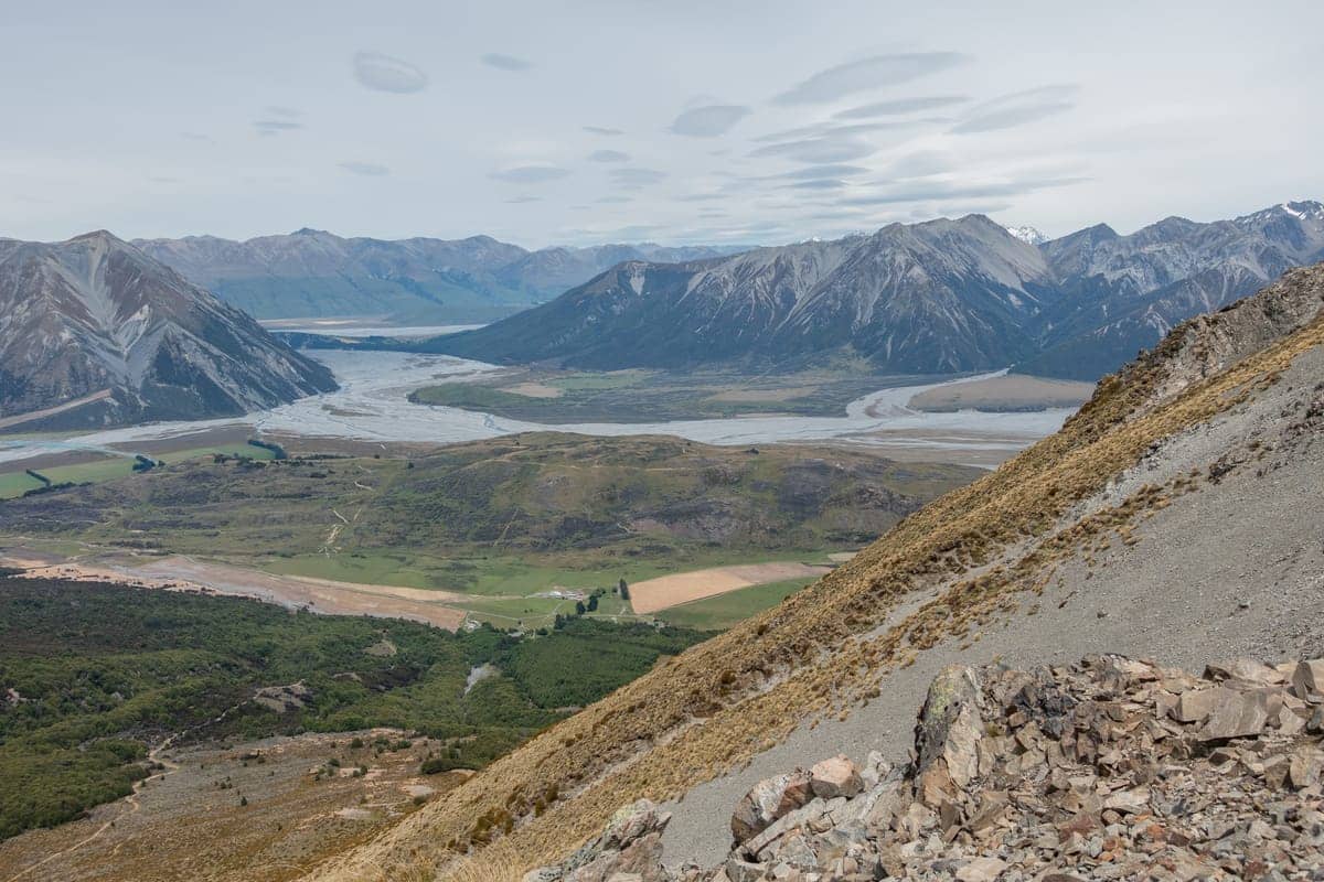
Peak Hill is the standout day walk in the Lake Coleridge basin: a 1,240m summit wedged between the lake and the braided reaches of the Rakaia, in the Peak Hill Conservation Area. From the top, the view takes in the full length of Lake Coleridge, the Rakaia and Wilberforce river systems, and the main divide of the Southern Alps — a genuine 360-degree panorama, and the reason this route has quietly become one of Canterbury's most photographed hill climbs.
This is a route rather than a groomed track. It starts from a DOC sign on Algidus Road, about nine kilometres past Lake Coleridge Village, crosses a marked easement over private farmland, then climbs steeply to a ridge before a more gradual pull to the summit. DOC grades it for experienced trampers and the climb is honest — around 650m of ascent, with sections that are eroded, gravelly and slippery on the way back down.
The setting is classic Canterbury high country: tussock, scree, matagouri, and enormous skies, with no facilities of any kind — no toilets at the car park, no water on the hill, and patchy cellphone coverage. The nearest shops and fuel are about an hour away in Methven or Darfield. That remoteness is a large part of the appeal, but it means the walk rewards preparation in a way the foothill tracks near town do not.
What to expect
Budget around two hours to the summit and three to four hours return, over roughly 5.5km round trip with 650m of climbing. The route starts deceptively — a flat walk across grazed paddocks on the marked easement — before the hillside rears up and the real work begins. The steep section eases into undulating ridgeline as you approach the top, where a summit cairn marks the high point at 1,240m.
Underfoot, expect an unformed, marked route rather than a benched track: worn ground, loose gravel and eroded pinches, particularly awkward on descent. Good tramping boots matter here, and a walking pole earns its place on the way down. The route is extremely exposed to the weather — DOC repeats this warning for a reason — and Canterbury nor'westers hit this basin hard. If it is blowing at the car park, it will be worse on the ridge.
Keep to the marked easement across the farmland at the start, leave gates as you find them, and expect livestock on the lower slopes and along Algidus Road, where the last several kilometres of driving are gravel. Parts of the conservation area are open to hunting, so a bright layer is not a bad idea outside the easement section. There is no shade and no water source on the route — carry everything you need.
Best time to visit
Pick the day, not the season: Peak Hill is best on a clear, calm day and unpleasant in wind at any time of year. Late spring through autumn gives the most reliable conditions and long daylight. Winter ascents are popular for snow-covered views of the Alps but the route can carry snow and ice near the top, and the exposure becomes serious — only go equipped and experienced. In high summer, start early; there is no shade and the climb faces the sun.
Insider tips
- ✓Check the forecast and do not commit in a strong nor'wester — the route is extremely exposed from the ridge up.
- ✓Wear tramping boots with good grip; the descent is eroded, gravelly and slippery.
- ✓Carry all your water — there is none on the route and no shade either.
- ✓There are no toilets at the car park or anywhere on the walk; the last facilities are at Lake Coleridge Village.
- ✓The final stretch of Algidus Road is gravel through working farmland — drive to the conditions and watch for stock.
Frequently asked questions
How hard is the Peak Hill track?
DOC grades it as a route for experienced trampers rather than a walking track. The 650m climb is steep and sustained, the surface is unformed with eroded, gravelly sections, and the whole route is exposed to the weather. A reasonably fit walker with boots and a good forecast will manage it fine; it is not a casual stroll.
How long does Peak Hill take to walk?
Around two hours to the summit and three to four hours return, over roughly 5.5km. Add time for the summit itself — the 360-degree view over Lake Coleridge, the Rakaia and the Southern Alps is the point of the exercise.
Can you walk Peak Hill in winter?
Yes, and the snow-covered views are spectacular, but the route can hold snow and ice near the 1,240m summit and the exposure to wind and cold is serious. Winter ascents are for properly equipped, experienced walkers on a settled day.
Where should I stay when walking Peak Hill?
There are no services at the trailhead and only limited accommodation in the Lake Coleridge basin. Most visitors stay in Methven, about 50 minutes' drive away, which makes an easy base for Peak Hill, the Rakaia Gorge and Washpen Falls — see visitmethven.co.nz/stay.
Practical information
Price
Free
Location
Algidus Road, 9km past Lake Coleridge Village (55km from Methven town centre)
Stay near Peak Hill Track
Self-contained holiday homes in Methven — book direct and save.
Browse accommodation